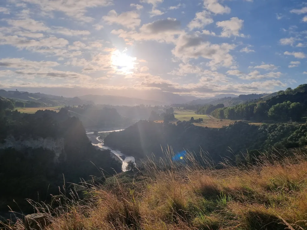

Our Heritage
Every place has a story.
Ours begins long before roads, railways or townships. It begins with the rivers that carved our landscape, the people who first called this place home, and the generations who have shaped Rangitīkei into the district we know today.
A land shaped by people and place
The history of Rangitīkei begins long before the towns, roads and boundaries that define our district today.
For generations, Māori communities have lived alongside its rivers, forests and fertile plains, establishing pā, kāinga and cultivations and building deep connections with the whenua that continue today.
Ngā Wairiki Ngāti Apa have a particularly strong association with the southern Rangitīkei and the Rangitīkei River, with communities established along the awa from its lower reaches towards the coast. The river provided food, fresh water and transport, while connecting people and communities across the rohe.
Further inland and north, the story becomes one of many interconnected iwi and hapū. Ngāti Hauiti have longstanding connections through the central Rangitīkei, while Ngāti Hinemanu, Ngāti Paki, Ngāti Rangituhia, Ngāti Tamakōpiri and Ngāti Whitikaupeka are among those with ancestral connections across the northern reaches of the district and the wider Mōkai Pātea rohe. Ngāti Raukawa and Ngāti Parewahawaha also have enduring connections around the southern Rangitīkei.
The early nineteenth century brought significant change as migrations, relationships and conflicts between iwi reshaped communities throughout the lower North Island. The arrival of Te Rauparaha and Ngāti Toa, along with allied iwi, was part of this complex period and had a profound effect on the people already living throughout the region.
Those histories are not simply stories of the past. The iwi and hapū of Rangitīkei remain an important part of the district today, maintaining their relationships with ancestral lands and waterways through whakapapa, marae, kaitiakitanga and living communities.
Together, these connections form an essential part of the story of Rangitīkei and continue to shape the identity of the district we share today.
A new chapter
European settlers began arriving during the 1840s, drawn by fertile land and opportunity. With few formed roads, many travelled north from Wellington, crossing the Rangitīkei River by Thomas Scott's ferry before establishing farms and settlements along the district's rivers and coastline.
As agreements for land settlement were reached, communities gradually expanded inland. By the late 1850s, settlements stretched from Parewānui and Turakina through to Marton, Pōrewa and Tūtaenui, laying the foundations for many of the communities that continue to thrive today.

Many settlers had to cross treacherous parts of the Rangitīkei River by horse and cart until bridges were built.
Building connections
As the district grew, so too did the need to connect people.
The arrival of Cobb & Co coaches in 1868 linked Rangitīkei with Wellington and Whanganui, bringing mail, passengers and goods along rough roads, across rivers and through challenging terrain.
Rail soon followed. The first railway reached the district in 1878, forever changing how people travelled, traded and settled. By the early twentieth century, Taihape had become an important railway town, with the North Island Main Trunk helping open the central North Island and strengthening Rangitīkei's place within it.
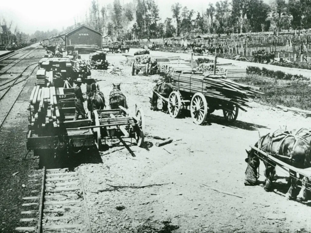
The building of the North Island Main Trunk Railway Line was a gamechanger for the district, bringing much needed employment for many people, as well as making the district more accessible to larger towns and cities in the North Island.
A district built together
The Rangitīkei County was one of the first counties established under the Counties Act 1876, marking the beginning of local government in the district.
Since then, generations of farmers, business owners, iwi, volunteers, community organisations and residents have shaped the district through hard work, resilience and a deep connection to the land.
From the productive farms of the fertile plains to the dramatic hill country, from heritage townships to thriving rural communities, Rangitīkei has continued to evolve while holding firmly to the values that have defined it from the beginning.
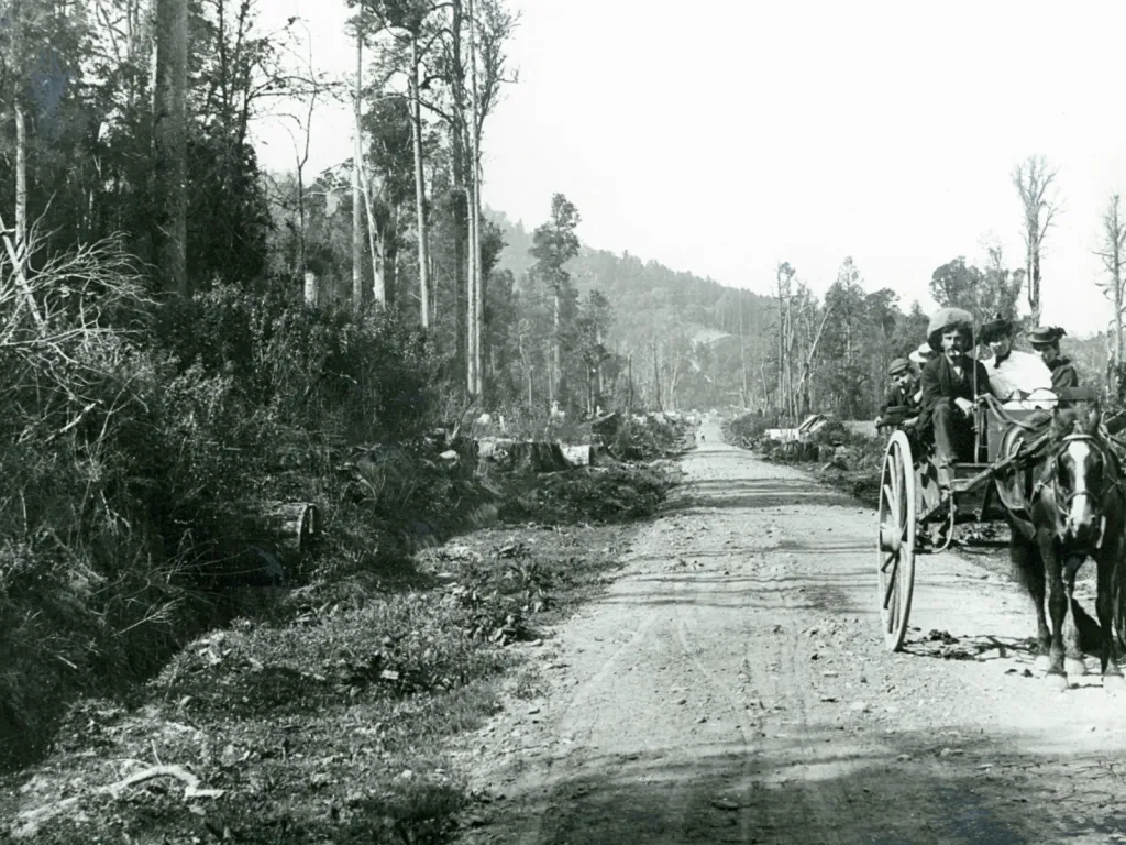
Rangitīkei was cloaked in thick bushland, like much of the nNorth Island, and this was cleared by settlers to make way for farmland. Timber cut from the forest was used throughout the country for building.
Our story continues
Today, Rangitīkei is a district that proudly celebrates both its heritage and its future.
It's a place where history lives alongside innovation, where rivers, railways and rural communities continue to shape everyday life, and where people work together to care for the places they call home.
Our story didn't end with the arrival of the railway or the establishment of local government.