April 2017 Flood Event - Evacuation Map
April 04, 2017
Note: This Public Notice is out of date, and is retained for archival purposes only.
4 April 8:00pm
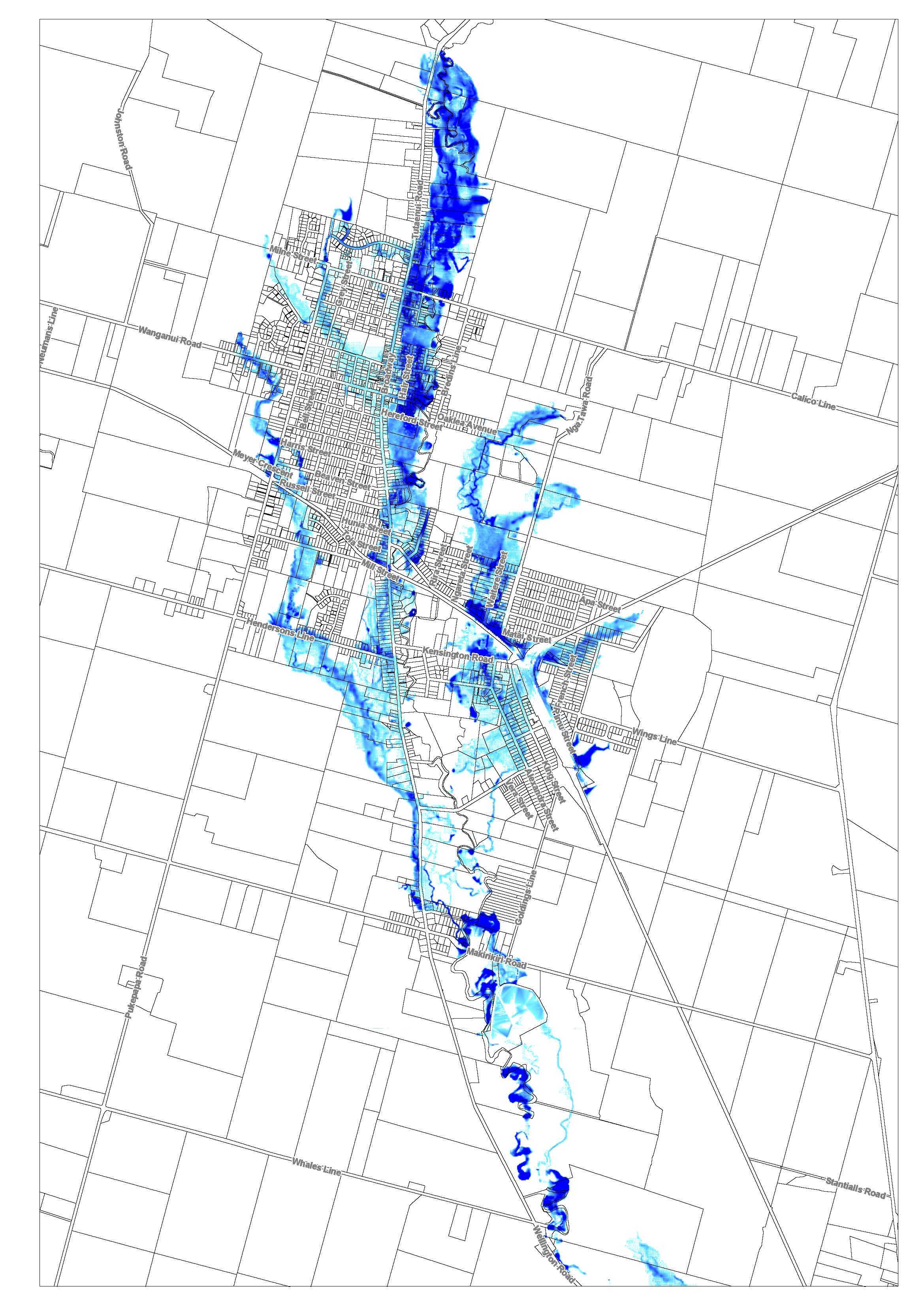
Rangitikei District Council declared a state of emergency at 5.30pm tonight (Tuesday, 4 April) due to the significant amount of rain expected overnight and tomorrow. Evacuations have commenced in Marton for those in the surrounding area of the Tutaenui Stream. The area being covered is shown in blue in the map below – this is based on the a .5 meter flooding event, based on Horizons Regional Councils models for a 1 in 200 year event.
Evacuation Map
4 April 6:30pm
The Council has just received new information from Horizons Regional Council and Met Service about the forecast rain that is now expected in our District. The rain levels are now predicted to be significantly more than previously thought – they could be at the same levels experienced in 2004. Therefore the Rangitikei District Council has decided to declare a state of emergency to deal with the expected impact. Residents that may be affected by the Tutaenui stream flooding will be evacuated this evening. There are likely to be evacuations at Whangaehu and Turakina on Wednesday.
Key impacts across Rangitikei are:
- Tutaenui Stream – expected to be at a similar level to 2004 event in the early hours of Wednesday, 5 April
- River level at Whangaehu / Kauangaroa expected to be 15m at 3pm on Wednesday, 5 April
- River level at Turakina expected to be 11.6m at 6.45pm Wednesday, 5 April
- River level for the Rangitikei River is not expected cause concern.
The Council will provide updates as they become available. Anyone who is concerned about themselves or their property please contact the Council on 0800 422 522.