

Taihape West Slip Monitoring
The Taihape West Slip is an area of historic land movement on the western side of Taihape.
Rangitīkei District Council has previously monitored the slip to better understand its behaviour and help inform how potential risks associated with it are managed.
Council has commissioned Earth Sciences New Zealand to undertake a new survey of the slip, with field work planned between 31 August and 3 September 2026 (weather dependent).
The survey will provide up-to-date measurements that can be compared with information collected previously, helping us build a clearer picture of the slip over time and supporting future planning and risk management.
Most of the survey work will take place within the road reserve, the former school grounds and hospital land. Earth Sciences New Zealand will also need to access a small number of private properties where existing survey points are located.
Affected property owners will be contacted before access to their property is required.
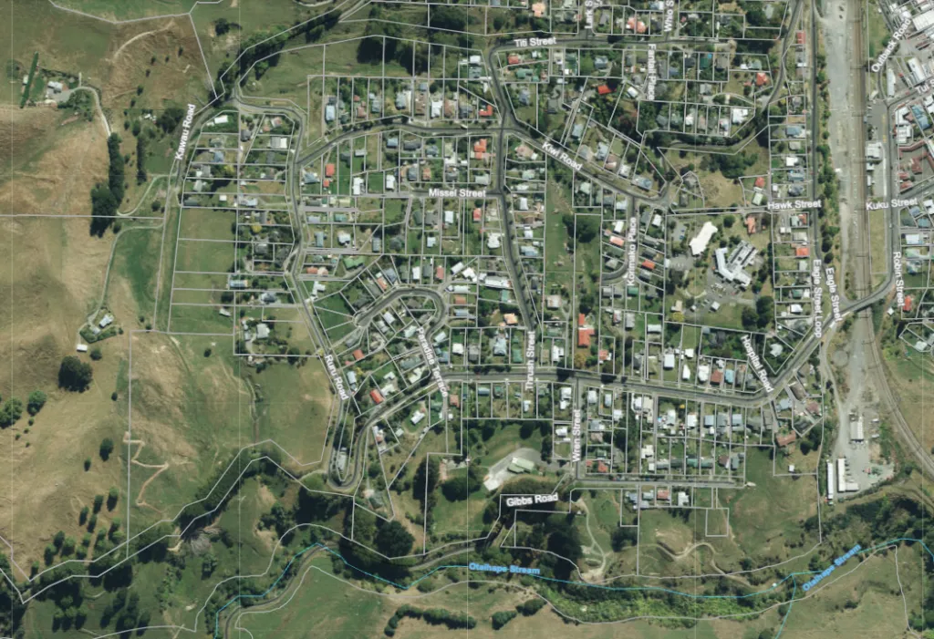
The area where the Taihape West Slip monitoring will be undertaken from 31 August to 3 September (weather dependent).
What you need to know
The Taihape West Slip is an area of land in western Taihape that Council has previously monitored to help understand the landslide and inform future risk management.
No. This work is not being undertaken in response to a recent event or new concern about the slip.
Monitoring provides information about the slip and allows measurements taken at different times to be compared.
Having current information helps Council build a better understanding of the area and supports informed decisions about future planning and risk management
Earth Sciences New Zealand is planning to undertake the field work between 31 August and 3 September 2026 (weather dependent).
Timing may be subject to change depending on conditions and the progress of the survey.
In some cases, yes.
Most of the existing survey points are located within the road reserve, the former school grounds and hospital land. However, several points are located on private properties.
Where access to private property is required, Earth Sciences New Zealand will endeavor to seek your permission prior to entering your private property.
This will depend on the type of survey point located on the property.
At most locations, surveyors will locate an existing survey mark and hold surveying equipment over it for a few minutes while measurements are taken.
If a survey mark has become covered by soil, surveyors may need to carefully uncover it using a spade. Any soil removed will be replaced and the area refilled to minimise disruption.
At several main control points on farmland, a tripod will need to be set up and remain in place during the day while measurements are collected.
Earth Sciences New Zealand specialists may also walk over parts of the property to visually inspect the form and structure of the land.
Minimal disruption is expected.
The information collected will give Council updated measurements of the Taihape West Slip.
This can be compared with previous information to improve our understanding of the area and help inform future risk management and planning.
Council will consider the findings once the survey work and subsequent analysis are complete.
Please contact Rangitīkei District Council on 0800 422 522 or email tiffany.gower@rangitikei.govt.nz.